Thinking about Burlingame but not sure which neighborhood or school zone fits your family best? You’re not alone. Between its walkable downtown blocks, leafy west‑side hills, and a well‑regarded TK–12 public pathway, there’s a lot to weigh. In this guide, you’ll learn how Burlingame’s neighborhoods differ east and west of El Camino Real, how school assignments work, and the quick checks to confirm any specific address. Let’s dive in.
East vs. west of El Camino Real
East side overview
The east side of El Camino Real is flatter and centered on Burlingame Avenue and Broadway. You can expect shorter blocks, frequent sidewalks, and easy access to shopping, dining, and the Caltrain station. Many buildings near downtown are condos or older apartments, and there are single‑family homes on smaller lots in adjacent neighborhoods. The City’s overview of Burlingame Avenue and Broadway corridors is a helpful starting point.
Walkability generally runs high near downtown. Central blocks around Burlingame Avenue often score in the 90s on Walk Score, which indicates a “walker’s paradise.” You can see a representative example using Walk Score’s downtown Burlingame location.
West side overview
West of El Camino Real, the terrain rises into the Easton Addition, Burlingame Hills, Mills Estates, and nearby pockets. Streets curve, lots tend to be larger, and many homes are single‑family properties with more yard space. Daily errands are more car‑dependent in many west‑side areas, though some streets offer views and quieter residential settings. If you want space and privacy, the west side often delivers that feel.
Neighborhood snapshots
- Downtown and Burlingame Avenue: Main retail and dining hub, frequent community events, short walks to shops and the historic Caltrain station. Housing includes condos and classic apartment buildings, plus a few single‑family pockets on the edges.
- Broadway corridor: Smaller scale shops and restaurants that feel a bit quieter than Burlingame Avenue. Popular for quick errands and a relaxed main street vibe.
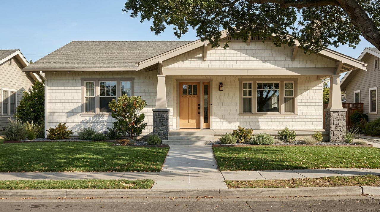
- Burlingame Terrace, Lyon‑Hoag, Burlingables, and Burlingame Village: Tree‑lined residential blocks near downtown. You’ll see many pre‑ and post‑war bungalows, modest yards, and easy access to parks and playgrounds.
- Burlingame Gardens and Oak Grove Manor: Flat residential areas east of El Camino with a mix of single‑family homes and multi‑unit buildings, generally convenient to Highway 101.
- Easton Addition: Leafy streets and larger lots west of El Camino. A long‑time favorite for buyers seeking classic single‑family homes and more privacy.
- Burlingame Hills, Mills Estates, and Ray Park: Higher elevation, curving streets, and larger parcels. Many homes here are more car‑centric, and some offer ridge or Bay views.
- Bayfront and Hotel Row: Along Highway 101 near the Bay and SFO. Handy for airport access and Bay Trail recreation, but proximity to flight paths and freeways makes due diligence on noise especially important.
Public schools at a glance
Burlingame’s public TK–8 schools are run by the Burlingame Elementary School District (BSD), which operates six elementary schools plus a single middle school. You can see district information and links to each campus on the Burlingame Elementary School District site.
- Elementary schools (TK–5): Franklin, Hoover, Lincoln, McKinley, Roosevelt, Washington.
- Middle school (6–8): Burlingame Intermediate School.
- High school: Students attend schools in the San Mateo Union High School District based on address, with many Burlingame addresses assigned to Burlingame High School. Use the district’s School Locator and Boundaries to confirm.
Program notes families often ask about:
- Spanish Dual Language Immersion is hosted at McKinley Elementary. Details are available directly from McKinley Elementary’s site.
- Burlingame Intermediate School has been recognized by the National Blue Ribbon Schools Program. See the official Blue Ribbon listing for BIS for context.
How to confirm your school zone
School attendance areas are set by the districts and reviewed over time. Neighborhood labels are not a substitute for an address‑level check. Always verify a specific home’s assignments before you decide.
Follow these quick steps:
- Look up the address in BSD’s interactive School Explorer to see the assigned elementary and middle schools. Use the BSD School Explorer.
- Confirm the assigned high school using SMUHSD’s School Locator. Start here: SMUHSD School Locator and Boundaries.
- If you still have questions, call the district enrollment office or the school front office. Contact links and phone numbers are on the BSD district site.
Transfers and exceptions can be possible, but they depend on capacity and program seats. If you are prioritizing a specific program, contact the district early.
Walkability, parks, and daily life
Walkability highlights
If walking to coffee, groceries, and the train matters to you, look near Burlingame Avenue or close‑in neighborhoods like Burlingame Terrace and Lyon‑Hoag. Central blocks around the Avenue often earn “walker’s paradise” scores in the 90s. You can see a representative example using Walk Score’s downtown view. As you move west into the hills, walk scores typically drop and daily errands may require a car.
Parks and play spaces
Washington Park, a few blocks from Burlingame Avenue, is a popular daily hub with fields, courts, and a playground. You can preview amenities and location details on the City’s page for Washington Park. Smaller neighborhood play areas like Paloma Playground and Village Park offer easy options for quick outings. For weekend variety, families often add the Bay Trail or nearby Coyote Point to their rotation.
Transit and commuting
Burlingame’s historic Caltrain station sits near Burlingame Avenue. Many residents choose homes within a 5 to 15 minute walk to simplify commutes to San Francisco or down the Peninsula. For a quick orientation, see the Burlingame Railroad Station overview, then check current Caltrain timetables for travel times. If you drive, US‑101 and I‑280 provide north and south corridors, with east‑side homes offering faster access to 101 and west‑side hills closer to 280.
Airport proximity and noise checks
Burlingame sits near the SFO flight corridor, especially along the Bayfront and Hotel Row. Noise exposure varies by block, weather, and runway use. If airport noise is on your radar, use SFO’s public tools to review flight tracks and recent noise data for any address you are considering. Start with the SFO Aircraft Noise Tracker, and contact the SFO Noise Office if you need more context.
Shortlisting checklist for families
Use this simple framework when comparing homes and neighborhoods:
- List your top three priorities, such as elementary assignment, walkable location, or lot size. Be ready to trade across categories since no single block checks every box.
- Verify school zones for any address using BSD’s School Explorer and SMUHSD’s School Locator.
- Check Walk Score for each address to compare daily convenience. Downtown blocks usually score very high, and the west‑side hills trend lower.
- Visit twice, once on a weekday morning to see commute traffic and once on a weekend midday to feel park and playground routines. Note distance to Washington Park or a nearby playground.
- If you are concerned about airplane noise, run the address through SFO’s Aircraft Noise Tracker and consider asking sellers about window or insulation upgrades.
- Map your commute, childcare, and activity runs. Proximity to the Burlingame Caltrain station or to your preferred freeway can save meaningful time each week.
- If a specific program like Spanish Dual Language Immersion is a must, review McKinley’s program details and contact the district early about capacity and timelines.
Final thoughts and next steps
Burlingame offers a rare mix of charming downtown streets, family‑friendly parks, and a clear TK–12 public school pathway. Your ideal fit will come down to priorities. If you want high walkability and a short train walk, start east of El Camino near the Avenue or Broadway. If you want larger lots and a quieter residential setting, explore Easton Addition, Mills Estates, and the hills.
Have questions about a specific street, school zone verification, or how to balance walkability with space? We live and work here, and we’re glad to help you compare options address by address. For a thoughtful plan to buy or to prep your current home for sale, connect with the Watson Marshall Group to get started.
FAQs
How do school zones work in Burlingame?
- BSD sets elementary and middle boundaries, and SMUHSD assigns high schools by address, so always verify a specific property using BSD’s School Explorer and SMUHSD’s School Locator.
Which Burlingame neighborhoods are most walkable?
- Areas near Burlingame Avenue and close‑in east‑side blocks, like parts of Burlingame Terrace and Lyon‑Hoag, tend to be very walkable, while west‑side hills are more car‑dependent.
Where can I find Spanish Dual Language Immersion in Burlingame?
- McKinley Elementary hosts BSD’s Spanish Dual Language Immersion program, and program details are available on the McKinley site.
What should I know about Burlingame Intermediate School?
- It is the district’s single middle school for grades 6–8 and has been recognized by the National Blue Ribbon Schools Program.
How can I check airplane noise near a Burlingame home?
- Use SFO’s Aircraft Noise Tracker to view recent flight paths and noise contours for a specific address, then contact the SFO Noise Office if you want more detail.
How far is downtown Burlingame from the Caltrain station?
- Many downtown blocks are within a 5 to 10 minute walk of the station, but always map your exact address and check current Caltrain schedules for timing.